Destinations
Experiences
|
|
L
A D A T C O T O U
R S |
|
||||||||
| HOME | South America | Falkland Islands | Antarctica |
Unique Destinations |
Unique Experiences |
Newsstand | ||||
|
|||
|
|
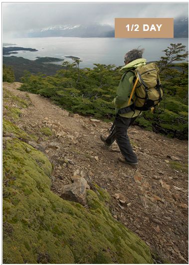 |
TREKKING CERRO LA BANDERA LANDMARK PLACES: Cerro La Bandera, Dientes de Navarino, Laguna and Robalo Valley, Beagle Channel and Tierra del Fuego.
We will go to the Agua de Río Róbalo intake to begin our medium-intensity circuit, ascending to 600 meters above sea level on a very well marked trail to the top of the Bandera, a landmark hill that gives the Trekking its name.
From this magical place we will observe a panoramic view of Puerto Williams, the Beagle Channel, and the mythical Tierra del Fuego, and then we will go a little further towards the Róbalo Valley, and contemplate the imposing view that unfolds from the Dientes de Navarino mountain range.
Finally, we will make our way back down the valley of the Róbalo river, passing through different landscapes such as the Róbalo lagoon, forest and peat bog, until we reach the starting point where the Errante team awaits us to return home. (This trail is also the beginning of the Dientes de Navarino circuit, recently recognized as the best trekking in Chile). |
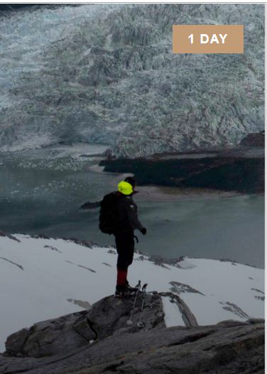 |
Glaciers Cordillera Darwin LANDMARK PLACES: Holland Glacier, Italia Glacier, Hoste Island
We start sailing towards the East, to take the north arm of the
Beagle Channel until we reach the first glaciers of the Darwin
mountain range. These majestic glaciers are part of the Alberto de
Agostini National Park, and make up the southernmost ice field on
the continent. Navigation is a true experience before the intense beauty of pristine landscapes that run through the channels, observing in detail the birds and their marine fauna, being common to find dolphins, sea lions, penguins and even whales.
If the weather allows it, we will descend on the white sand beach that forms at the foot of the Holanda Glacier to take a short walk and approach this amazing mass of ice.
|
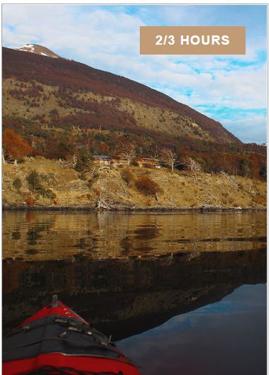 |
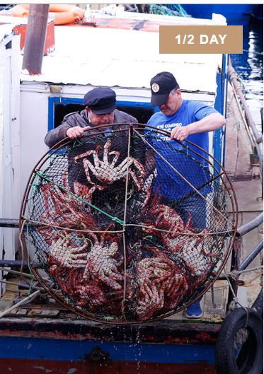
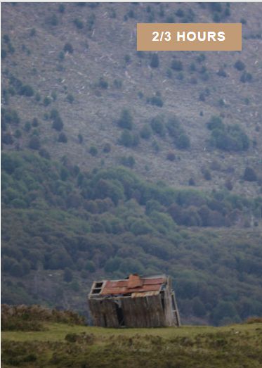
KAYAKING – THE ROUTE OF ANCIENT CANOEISTS LANDMARK PLACES: Caleta Paula, Pesquera McLean, Bahia Virginia 2 to 3 hours
We will begin with a technical talk by the fire in the Errante Shelter, to delve into the historical atmosphere of a way of life: that of sailing in bark canoes whose construction accounts for the deep understanding of the environment and in this case of the life cycle of the native forest, which developed the Yagán culture, ancient inhabitants of Navarino.
Our tour begins in the Beagle Channel directly from the ecolodge, sailing through the area of Caleta Paula and Bahía Virginia. In the circuit uninhabited beaches and corners of majestic landscapes are discovered, following the passage of the Beagle Channel; We will be contemplating the characteristic marine fauna: from coastal birds, curious sea lions and even penguins.
We will paddle around the coast through areas of "Conchales", archaeological sites that correspond to the places where the Yaganes stopped and set up their camps in the sheltered coastal points of the sea. The shell mounds have a characteristic shape of circular depressions made up of rings of shell mounds of varying height, which were later covered by a layer of vegetation.
This form accounts for their nomadic life wandering through the canals: the accumulation over thousands of years of the remains of their diet based on seafood, along with instruments and bones around the huts that they set up cyclically in the same places. protected from the sea. These sites of great archaeological value have allowed us to deepen our knowledge of the rich culture of this ancestral people. This tour allows you to discover the magic of this island, where history literally builds up in layers of the coastline. |
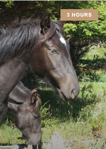 |
WANDERING CAVALCADE LANDMARK PLACES: Zanartu Peninsula and Lagoon, Robalo Bay and River
This magical horseback riding tour begins with a technical talk with the local guide and owner of the horses, and then goes out to tour the Zańartu Peninsula along the coast through the Róbalo Bay towards Caleta Paula until we reach the ecolodge where a well-deserved “ eleven” Chilean.
It is a tour that takes us through all the existing landscapes on the island: beach, steppe, lagoons, rivers and forest, accompanied by the experience of a local gaucho.
The route can be modified according to the technical abilities of the group, road and weather conditions according to the experience of the guide.
|
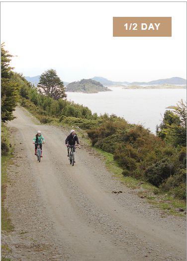 |
MOUNTAIN BIKING LANDMARK PLACES: Peninsula and Laguna Zanartu, Punta de Gusano, airport
Our favorite Mountain Bike route crosses places of immense beauty, to reach, if the tide allows it, a coastal bird nesting area where we can enjoy a frontal view of Puerto Williams from the sea, with the Dientes de Navarino as a backdrop. background.
We will start pedaling from the ecolodge along the main route of the island, to the fork to the aerodrome along the coast of Bahía Róbalo, passing through old roads and areas where there are still old trenches and weapons from the conflict with Argentina in 1978, where we will also meet with a magnificent view of the Beagle Channel and from where we can see the neighboring city of Ushuaia.
Finally we will surround the Lagoon to Punta de Gusano, the extension of land that will allow us to look at the city face to face, from the perspective of the sea, then we return to the ecolodge along the main road enjoying the postcards that nature gives us.
|
 |
PUERTO WILLIAMS CITY TOUR
We will visit the landmarks of the southernmost city in the world while we talk with local personalities, getting to know historical places such as the Martin Gusinde Anthropological Museum, which bears the name of this important German anthropologist, one of the few who were able to live with the Yagán people when he still lived in his traditional way, whose ethnographic record is one of the few that exists and that this museum protects together with many pieces found in the archaeological sites of the island.
We will visit the Micalvi Yacht Club, the last place of landfall on the way to Cape Horn and Antarctica, a meeting place for sailors from all over the world, who shelter their boats around the Micalvi, a transport ship that sailed the Rhine at the beginning from the last century and that today works as a pontoon, a place where there are plenty of stories of adventures in these brave southern seas.
We will continue walking along the coast towards the naval plateau, where Puerto Williams was founded and where the first house and church of the city are located. We will also get to know the everyday places of this picturesque town, such as the shopping center, the civic center and the fishermen's wharf, to understand how day to day goes by on this remote island.
Then we will visit Villa Ukika, where most of the current Yagán community currently lives, to finish the tour sharing in the Puerto Luisa cafe on the shores of the Beagle Channel, and part of the port terminal of the ferry that supplies this city, a boat that arrives every Saturday from Punta Arenas, marking the rhythm of life in this small town, capital of the Antarctic province of Chile. |
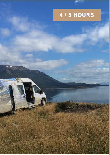 |
HERITAGE SCENIC ROUTE LANDMARK PLACES: Navarino Island, Puerto Navarino, Murry Channel 4 to 5 hours
We will travel the main route of Navarino Island: 50 km bordering the north coast of the island to the west. It is a route of great scenic beauty, where we will go in the Van Errante making stops at landmarks, while a local guide tells us stories and cultural and natural legacy of the Island.
The route ends Arriving at Puerto Navarino with the option of walking along the beautiful shore of the Beagle Channel, with the city of Ushuaia in front and the Darwin mountain range in the background, we go to the west where the silhouettes of the mountains of Hoste Island can be seen, the neighboring island separated from Navarino Island only by the mythical Murray Channel .
A journey through time and the surprising subantarctic nature of the most remote Patagonia.
|
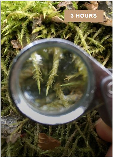 |
OMORA ETHNOBOTASNICAL PARK LANDMARK PLACES: Omora Park, Navarino Island
A unique tour through Omora Park, or “hummingbird-park” in the Yagán language. A guided circuit to discover with a magnifying glass the miniature forests of the Cape Horn Biosphere Reserve, where changing the lens of how we look at the environment is perhaps the first step to begin to truly observe.
This subantarctic habitat concentrates 5% of all the species of lichens, mosses and liverworts, being considered an important hotspot of biodiversity representative of the Area. A metaphor of how we should look at our environment and a reflection on how we relate to it.
|
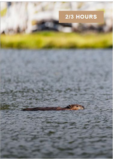 |
CASTOR THE DESTROYING ENGINEER MILESTONE PLACES
These animals were introduced in Ushuaia Argentina around the 1940s, mainly for the export of their skins, however, due to the Second World War, their market was reduced, and the industry was abandoned.
It is said that only 25 pairs of beavers were released so as not to have to kill them. These skilled animals managed to survive and today they are one of the most uncontrolled invasive species in these southern lands since they can swim through the sea and colonize different habitats, completely altering the riverbeds and riparian forest
|
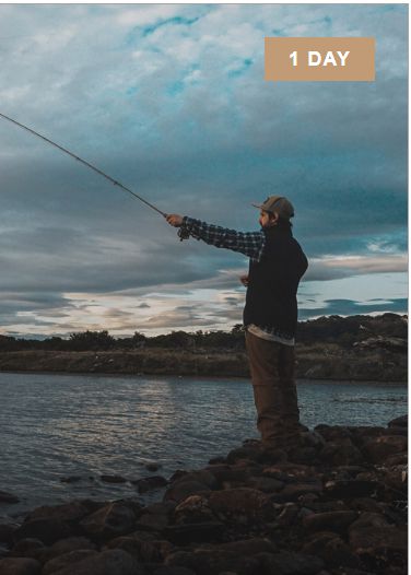 |
NAVARINO STYLE FISHING & HIKING MILESTONES: Lenga and coigue forest, centennial peat bog area, Valle Guerrico Lagoons
This is a journey that requires high spirits and a willingness to adventure, it is also an excellent panorama for families with young children and groups of friends who are looking for a day of walking of low difficulty and enjoyment in nature itself. It is not necessary to know how to fish to live this magical fishing experience, where people manage to connect with the living and pristine nature of Isla Navarino. We will travel 10 km to the mouth of the Guerrico River where the local fishing guide awaits us to begin our 7 km walk to the first lagoon, crossing an ancient forest of coigües, lengas and ńirres.
Then we will cross a peat bog to reach the refuge in front of the first lagoon that is 300 meters above sea level. After a break in the refuge, we continue for about 40 more minutes until we reach the second lagoon, renowned for its trout fishing. For those who want to go even further, there is a third lagoon 1 hour further on foot. There is the option of staying in the refuge to simply rest, share and enjoy this natural paradise, while those interested in fishing enter the valley to the lagoons. If the group wishes, they can end the day with a barbecue of products premises of Estancia Guerrico, in the Refuge. Finally we will walk back to the starting point where the Van awaits us to return to the ecolodge. |
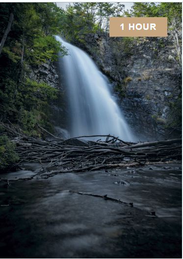 |
THE BRONZES WATERFALLS MILESTONES: Panoramic view Virginia Bay & Beagle Channel, Los Bronces Waterfall The waterfall and river Los Bronces have a special value for the Wanderer. Its waters supply this essential element to the ecolodge. They have been studied together with the rest of the rivers of Navarino Island and recognized as the purest water in the world.An extreme fishing adventure at the edge of the world: Lake Windhond, a place that will undoubtedly leave you breathless: you will travel through the purest ecosystems in the world, accompanied by the Antarctic wind and water such as rain, river, lake, peat or sea, putting us to the test at all times...
The waterfall and river Los Bronces have a special value for the Wanderer. Its waters supply this essential element to the ecolodge. They have been studied together with the rest of the rivers of Navarino Island and recognized as the purest water in the world.
Approximately 25 minutes of walking from the ecolodge, following the Bronces River through a beautiful ancient forest of lengas, coihues and ńirres (Nothofagus sp), is the 10-meter waterfall. The path leads us to its feet to contemplate the energy of the falling water and how its presence fills the environment with life. The trail continues around it and ascends to the point where the water falls, 100 meters above sea level, giving us an impressive view of the Beagle Channel. It is an ideal place to sit and contemplate the horizon. A small bridge allows you to cross over the river and go down the other bank until you reach the beginning of the path, where the river flows into the sea. We continue to the beach to return along the coast to the ecolodge, observing the different types of birds that we can find throughout the route. |
 |
VIRGINIA BAY MILESTONES: Virginia Bay, Conchales Walking west from Errante, 2 km away is Bahía Virginia, a place to contemplate native flora and fauna, where we will observe various birds in the transition between the sea and the forest.
From woodpeckers, Caranchos, Tiuques, Caiquenes, Carancas, Pato Quetro, to sea birds such as Pilpilenes, Gulls, cormorants, Albatrosses, Petrels. If we are lucky, we will be able to see penguins, sea lions and at some times of the year it is even possible to see whales swimming near this beautiful bay surrounded by Nothofagus forest, the characteristic forest of this subantarctic region.
On the way we find a large number of "Conchales" archaeological sites that correspond to the places where the Yagans stopped and set up their camps in the sheltered coastal points of the sea. The shell mounds have a characteristic shape of circular depressions made up of rings of shell mounds of varying height, which were later covered by a layer of vegetation. This form accounts for their nomadic life wandering through the canals: the accumulation over thousands of years of the remains of their diet based on seafood, along with instruments and bones around the huts that they set up cyclically in the same places. protected from the sea. These sites of great archaeological value have allowed us to deepen our knowledge of the rich culture of this ancestral people. |
 |
Pta. Gusano, Zańartu Lagoon & Róbalo Bay MILESTONES: Worm Point, Zanartu Lagoon, Robalo Bay
The tour begins on the beach near the airport, where you walk along a bank of land that limits the Bay of Puerto Williams and where many coastal and sea birds nest.
It allows a panoramic view of the city of Puerto Williams, the
Micalvi Yacht Club with the Dientes de Navarino as a
backdrop. Characteristic postcard of the southernmost town in the
world where the sea meets the mountain. |